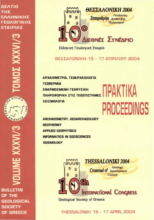
COST Action 625 Results: Monitoring of the Kaparelli fault, 2003-2006


Δημοσιευμένα: Jun 8, 2007
Λέξεις-κλειδιά:
Ενεργό ρήγμα Καπαρέλλι GPS ΤΜ-71 σεισμοί παραμόρφωση
A. Ganas
G. Drakatos
J. Bosy
L. Petro
B. Kontny
M. Stercz
N. S. Melis
S. Cacon
M. Papanikolaou
A. Pirentis
A. Kiratzi
Περίληψη

Η ευρύτερη περιοχή του Καπαρελλίου Βοιωτίας παρακολουθείται από διεθνή ομάδα γεωεπιστημόνων με σκοπό την μέτρηση της σύγχρονης παραμόρφωσης και την σύγκριση της με τα γεωλογικά δεδομένα από μετρήσεις υπαίθρου και παλαιοσεισμολογικές τομές. Η έρευνα ξεκίνησε το έτος 2003 με χρηματοδότηση κυρίως από το Ευρωπαϊκό πρόγραμμα COST Action 625. Εγκαταστήσαμε στο ενεργό ρήγμα του Καπαρελλίου α) δύο επιμηκυνσιόμέτρα τύπου ΤΜ-71 για την καταγραφή των κινήσεων πάνω στο επίπεδο του ρήγματος και β) έντεκα (11) σταθμούς GPS για την μέτρηση της παραμόρφωσης του στερεού φλοιού κοντά στο ρήγμα. Τα πρώτα αποτελέσματα είναι πολύ ενθαρρυντικά διότι βασίζονται σε καλής ποιότητας μετρήσεις και συγκρίνονται ευνοϊκά με τα γεωλογικά δεδομένα.

Λεπτομέρειες άρθρου
  • Ενότητα
  • Tectonic- Dynamic- Applied Geology
Λήψεις
Τα δεδομένα λήψης δεν είναι ακόμη διαθέσιμα.
Αναφορές
Altamini, Z., Sillard, P., and Boucher, C, 2002. ITRF2000: A new release of the International Terrestrial Reference Frame for Earth Science applications, J. Geoph. Res., 107 (BIO), 2214, doi: 10.1029/2001JB000561.
Ambraseys, N.N., and Jackson, J.A., 1990. Seismicity and associated strain of central Greece between 1890 and 1988, Geophysical J. Int., 101, 663-708.
Armijo, R., Meyer, B., King, G.C.P., Rigo, Α., and Papanastasiou, D., 1996. Quaternary evolution of the Corinth Rift and its implications for the Late Cenozoic evolution of the Aegean, Geophys. J. Int., 126, 11-53.
Bosy, J., and Kontny, B., 1998. Strategy of GPS data processing in local geodynamical networks, Reports on Geodesy No. 9(39), Warsaw University of Technology, Institute of Geodesy and Geodetic Astronomy, 105-113pp.
Bosy, J., Figurski, M., and Wielgosz, P., 2003. A strategy for GPS data processing in a precise local network during high solar activity, GPS Solutions, Volume 7, Number 2 Springer- Verlag, 120-129pp.
Brockmann, E., 1996. Combination of Solutions for Geodetic and Geodynamic Applications of the Global Positioning System (GPS) PhD. dissertation, Astronomical Institute, University of Berne, Berne, Switzerland.
Cacon, S., Kontny, B., Bosy, J., Cello, G., Piccardi, L., Tondi, E., Drakatos, G., and Ganas, Α., 2005. Local geodynamic researches in Polish Sudetes and the Mediterranean region, Reports on Geodesy, No. 2 (73), 231-244.
Clarke, P.J., Davies, R.R., England, P.C., Parsons, B., Billiris, H., Paradissis, D., Veis, G., Cross, P.A., Denys, P.H., Ashkenazi, V., Bingley, R., Kahle, H.-G., Muller, M.-V., and Briole, P., 1998. Crustal strain in central Greece from repeated GPS measurements in the interval 1989-1997, Geophys. J. Int., 135(1), 195-214.
Dobrev, N., and Kostak, B., 2000. Monitoring tectonic movements in the Simitli graben, SW Bulgaria, Engineering Geology, 57(3-4), 179-192.
Drakatos, G., Petro, L., Ganas, Α., Melis, N., Kostak, B., Kontny, B., Cacon, S., and Stercz, M., 2005. Monitoring of strain accumulation along active faults in the eastern Gulf of Corinth: Instrumentation and network setup, Acta Geodyn. Geomater., 2, No 1(137), 13-23.
Ganas, Α., Pavlides, S. B., Sboras, S., Valkaniotis, S., Papaioannou, S., Alexandris, G. Α., Plessa, Α., and Papadopoulos, G. Α., 2004. Active Fault Geometry and Kinematics in Parnitha Mountain, Attica, Greece, Journal of Structural Geology, 26, 2103-2118.
Goldsworthy, M., Jackson, J., and Haines, A.J., 2002. The continuity of active fault systems in Greece, Geophysical JournalInternational, 148, 596-618.
Hubert, Α., King, G., Armijo, R., Meyer, B., and Papanastasiou, D., 1996. Fault Re-activation, Stress Interaction and Rupture Propagation of the 1981 Corinth Earthquake Sequence, Earth & Planet. Sci. Lett., 142, 573-585.
Hugentobler, U, Sacher, S., and Fridez, P., 2001. Bernese GPS Software Version 4.2, Astronomical Institute, University of Berne, Switzerland.
Jackson, J.A., et al, 1982. Seismicity, normal faulting and the geomorphological development of the Gulf of Corinth (Greece): the Corinth earthquakes of February and March 1981, Earth ά Planet. Sc. Let., 57, 377-397.
King, G.C.P., Ouyang, Z.X., Papadimitriou, P., Deschamps, Α., Gagnepain, J., Houseman, G., Jackson, J.Α., Soufleris, C, and Virieux, J., 1985. The evolution of the Gulf of Corinth (Greece): an aftershock study of the 1981 earthquakes, Geophys. J. R. astr. Soc, 80, 677-693.
Kokkalas, S., Pavlides, S., Koukouvelas, I., Ganas, Α., and Stamatopoulos, L., in press. Paleoseismicity of the Kaparelli fault (eastern Corinth gulf): evidence for earthquake recurrence and fault behaviour, Bolletino di Geoßsica Teoretica ed Applicata.
Kostak, B., and Cruden, D.M., 1990. The Moiré crack gauges on the crown of the Frank Slide, Can. Geotech. J, 27, 835-840.
Kostak, B., 1991. Combined indicator using Moiré technique, Proceedings of 3rd international Symposium on Field Measurements in Geomechanics, Oslo, Norway, 53-60.
Maniatis, G., Lempp, CH., and Heinisch, Η., 2003. 3D strain monitoring of onshore active faults at the eastern end of the Gulf of Corinth (Greece), J. Geodynamics, 36, 95-102.
Pavlides, S., Koukouvelas, I., Ganas, Α., Kokkalas, S., Tsodoulos, I., Stamatopoulos, L., Goyntromichou, C, and Valkaniotis, S., 2003. Preliminary palaeoseismological results from the Kaparelli fault (Central Greece), Geophysical Research Abstracts, vol. 5, 07069, European Geophysical Society.
Roberts, G.P., and Ganas, Α., 2000. Fault-slip directions in central and southern Greece measured from striated and corrugated fault planes: Comparison with focal mechanism and geodetic data, Journal ofGeophysical Research, 105 (BIO), 23443-23462pp.
Stemberk, J., Kostak, B., and Vilimek, V., 2003. 3D monitoring of active tectonic structures, Journal of Geodynamics, 36, 103-112.
Τα περισσότερο διαβασμένα άρθρα του ίδιου συγγραφέα(s)