Neogene-Quaternary tectonic regime and macroseismic observations in the Tyrnavos-Elassona broader epicentral area of the March 2021, intense earthquake sequence

Published: Sep 24, 2021
Keywords:
2021 Tyrnavos-Elassona earthquake macroseismic observations ground deformation phenomena seismotectonics
Dimitrios Galanakis
https://orcid.org/0000-0002-5455-7774
Sotiris Sboras
https://orcid.org/0000-0002-7799-6761
Garyfalia Konstantopoulou
Markos Xenakis
Abstract
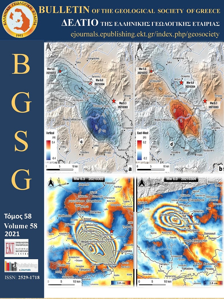
On March 3, 2021, a strong (Mw6.3) earthquake occurred near the towns of Tyrnavos and Elassona. One day later (March 4), a second strong (Mw6.0) earthquake occurred just a few kilometres toward the WNW. The aftershock spatial distribution and the focal mechanisms revealed NW-SE-striking normal faulting. The focal mechanisms also revealed a NE-SW oriented extensional stress field, different from the orientation we knew so far (ca. N-S). The magnitude and location of the two strongest shocks, and the spatiotemporal evolution of the sequence, strongly suggest that two adjacent fault segments were ruptured respectively. The sequence was followed by several coseismic ground deformational phenomena, such as landslides/rockfalls, liquefaction and ruptures. The landslides and rockfalls were mostly associated with the ground shaking. The ruptures were observed west of the Titarissios River, near to the Quaternary faults found by bore-hole lignite investigation. In the same direction, a fault scarp separating the alpidic basement from the alluvial deposits of the Titarissios valley implies the occurrence of a well-developed fault system. Some of the ground ruptures were accompanied by extensive liquefaction phenomena. Others cross-cut reinforced concrete irrigation channels without changing their direction. We suggest that this fault system was partially reactivated, as a secondary surface rupture, during the sequence as a steeper splay of a deeper low-to-moderate angle normal fault.
Article Details
  • Section
  • Natural Hazards
Downloads
Download data is not yet available.
References
Caputo, R., 1993. Morphotectonics and kinematics along the Tirnavos Fault, northern Larissa Plain, mainland Greece. Zeitsschrift für Geomorphol., 94, 167–185.
Caputo, R., Helly, B., 2005. Archaeological evidences of past earthquakes: a contribution to the SHA of Thessaly, Central Greece. Journal of earthquake engineering, 9(2), 199-222. doi: 10.1080/13632460509350539
Caputo, R., Pavlides, S. 1991. Neotectonics and structural evolution of Thessaly (Central Greece). Bull. Geol. Soc. Greece, 25, 119–133.
Caputo, R., Pavlides, S., 1993. Late Cainozoic geodynamic evolution of Thessaly and surroundings (central-northern Greece). Tectonophysics, 223, 339–362. doi: 10.1016/0040-1951(93)90144-9
Caputo, R., Chatzipetros, A., Pavlides, S., Sboras, S., 2012. The Greek database of seismogenic sources (GreDaSS): State-of-the-art for northern Greece. Ann. Geophys., 55, 859–894. doi: 10.4401/ag-5168
Chatzipetros, A., Pavlides, S., Foumelis, M., Sboras, S., Galanakis, D., Pikridas, C., Bitharis, S., Kremastas, E., Chatziioannou, A., Papaioannou, I., 2021. The northern Thessaly strong earthquakes of March 3 and 4 and their neotectonic setting. Bull. Geol.Soc., Greece, this volume.
DePolo, C.M., Clark, D.G., Slemmons, D.B. and Ramelli, A.R., 1991. Historical surface faulting in the Basin and Range province, western North America: implications for fault segmentation. Journal of Structural Geology, 13(2), 123-136. doi: 10.1016/0191-8141(91)90061-M
Dimitriou, D., Giakoupis, P., 1998. Mine research of coal deposit in Elassona: Domeniko sub-area. Technical report, Institute of Geological and Mineral Exploration (IGME), Athens [in Greek]
Earthquake Planning and Protection Organization – EPPO, 2000. Greek Antiseismic Regulation. EPPO, Athens.
Ferrière, J., Reynaud, J. Y., Pavlopoulos, A., Bonneau, M., Migiros, G., Chanier, F., Proust, J.N., Gardin, S., 2004. Geologic evolution and geodynamic controls of the Tertiary intramontane piggyback Meso-Hellenic basin, Greece. Bulletin de la Société géologique de France, 175(4), 361-381. doi: 10.2113/175.4.361
Ferriere, J., Chanier, F., Reynaud, J. Y., Pavlopoulos, A., Ditbanjong, P., Migiros, G., Coutand, I., Stais, A., Bailleul, J., 2011. Tectonic control of the Meteora conglomeratic formations (Mesohellenic basin, Greece). Bulletin de la Société Géologique de France, 182(5), 437-450. doi: 10.2113/gssgfbull.182.5.437
Galanakis, D., 1997. Neotectonic structure and stratigraphy Neogene and Quaternary sediments of Almyros-Pagasitikos basin, Pilio, Oreoi-Trikeri strait and Maliakos Gulf. PhD Thesis, Aristot. Univer. Thessaloniki, Unpub., 260 p.
Galanakis, D., Pavlides, S., Mountrakis, D., 1998. Recent Brittle Tectonic in Almyros -Pagasitikos, Maliakos, N. Euboia and Pilio. Bull. Geol. Society of Greece, 32(1), 263-273.
Giardini, D., Wössner, J., Danciu, L., 2014. Mapping Europe's seismic hazard. Eos, Transactions American Geophysical Union, 95(29), 261-262. doi: 10.1002/2014EO290001
Hatzfeld, D., Karakostas, V., Ziazia, M., Kassaras, I., Papadimitriou, E., Makropoulos, K., Voulgaris, N., Papaioannou, C., 2000. Microseismicity and faulting geometry in the Gulf of Corinth (Greece). Geophysical Journal International, 141(2), 438-456. doi: 10.1046/j.1365-246x.2000.00092.x
IGME – Institute of Geology and Mineral Exploration, 1987. Geological Map of Greece, “Elasson” sheet, 1:50.000 scale, IGME, Athens
IGME – Institute of Geology and Mineral Exploration, 1998. Geological Map of Greece, “Farkadon” sheet, 1:50.000 scale, IGME, Athens
ITSAK–DUTh, 2021. Thessaly Earthquakes M6.3, 03/03/2021 and M6.1, 04/03/2021. Preliminary Report. Research Unit ITSAK, EPPO and Department of Civil Engineering, DUTh. Thessaloniki. pp. 63. doi: 10.5281/zenodo.4641200
Kiratzi, A., Louvari, E., 2003. Focal mechanisms of shallow earthquakes in the Aegean Sea and the surrounding lands determined by waveform modelling: A new database. J. Geodyn., 36, 251–274. doi: 10.1016/S0264-3707(03)00050-4
Lekkas, E., Agorastos, K., Mavroulis, S., Kranis, C., Skourtsos, E., Carydis, P., Gogou, M., Katsetsiadou, K.-N., Papadopoulos, G., Triantafyllou, I., Agalos, A., Moraitis, S., Stamati, E., Psarris, D., Kaviris, G., Kapetanidis, V., Papadimitriou, P., Karakonstantis, A., Spingos, I., Kouskouna, V., Kassaras, I., Pavlou, K., Voulgaris, N., Mavrouli, M., Pavlides, S., Chatzipetros, A., Sboras, S., Kremastas, E., Chatziioannou, A., Kiratzi, A., Papazachos, C., Chatzis, N., Karakostas, V., Papadimitriou, E., Koukouvelas, Ι., Nikolakopoulos, Κ., Kyriou, Α., Apostolopoulos, D., Zygouri, V., Verroios, S., Belesis, A., Tsentzos, I., Krassakis, P., Lymperopoulos, K., Karavias, A., Bafi, D., Gatsios, T., Karatzia, M., Gkougkoustamos, I., Falaras, T., Parcharidis, I., Papathanassiou, G., Evangelidis, C.P., Karastathis, V., Tselentis, G-A., Ganas, A., Tsironi, V., Karasante, I., Valkaniotis, S., Galanakis, D., Kostantopoulou, G., Papadopoulos, N., Kourou, A., Manousaki, M., Thoma, T., 2021. The early March 2021 Thessaly earthquake sequence. Newsletter of Environmental, Disaster and Crises Management Strategies, 22, ISSN 2653-9454.
Michetti, A.M., Esposito, E., Guerrieri, L., Porfido, S., Serva, L., Tatevossian, R., Vittori, E., Audemard, F., Azuma, T., Clague, J., Comerci, V., 2007. Intensity scale ESI 2007 (La scala di Intensità ESI 2007). In: Guerrieri, L., Vittori, E. (Eds), Memorie Descrittive della Carta Geologica d’Italia, 74, Servizio Geologico d’Italia, Dipartimento Difesa del Suolo, APAT, Rome, pp. 41
Papazachos, B., Papazachou, K., 2003. Earthquakes of Greece. Ziti editions, Thessaloniki.
Perissoratis, C., Angelopoulos, I., Mitropoulos, D., 1991. Surficial Sediment Map of the Aegean Sea Floor, 1:200 000 scale, “Pagasitikos” Sheet, IGME, Athens.
Rigo, A., Lyon-Caen, H., Armijo, R., Deschamps, A., Hatzfeld, D., Makropoulos, K., Papadimitriou, P., Kassaras, I., 1996. A microseismic study in the western part of the Gulf of Corinth (Greece): implications for large-scale normal faulting mechanisms. Geophys. J. Int., 126(3), 663-688. doi: 10.1111/j.1365-246X.1996.tb04697.x
Sboras, S., 2011. The Greek Database of Seismogenic Sources: seismotectonic implications for North Greece. Pubblicazioni dello IUSS, 5(1), PhD thesis, Università degli Studi di Ferrara, pp. 252.
Silva, P. G., Guerrieri, L., Michetti, A. M., 2015. Intensity scale ESI 2007 for assessing earthquake intensities. In: Beer, M. et al. (Eds), Encyclopedia of Earthquake Engineering, Springer-Verlag, 1219-1237.
Tadono, T., Ishida, H., Oda, F., Naito, S., Minakawa, K., Iwamoto, H., 2014. Precise global DEM generation by ALOS PRISM. ISPRS Annals of the Photogrammetry, Remote Sensing and Spatial Information Sciences, 2(4), 71. doi:10.5194/isprsannals-II-4-71-2014
Woessner, J., Laurentiu, D., Giardini, D., Crowley, H., Cotton, F., Grünthal, G., Valensise, G., Arvidsson, R., Basili, R., Demircioglu, M.B., Stucchi, M., 2015. The 2013 European seismic hazard model: key components and results. Bulletin of Earthquake Engineering, 13(12), 3553-3596. doi: 10.1007/s10518-015-9795-1
Most read articles by the same author(s)